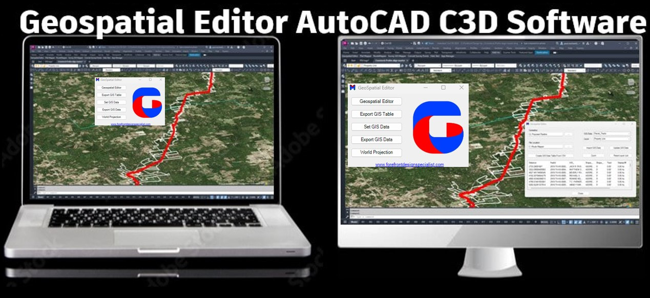
Geospatial Editor – The Ultimate GIS Data Automation Tool for AutoCAD Civil 3D & Map
The Geospatial Editor streamlines the global capture, editing, creation, analysis, and quality control of GIS data tables linked to crossings and blocks along a centerline route.
Effortless Global GIS Management
✔ Import, edit, and analyze GIS data across your entire project.
✔ Instantly detect and correct missing or inaccurate GIS data.
✔ Automate One-Call Reports and Right-of-Way Acquisition Totals with parcel ID control.
✔ Enhance GIS exchange and streamline project workflows for faster, smarter decision-making.
Key Features:
✅ Simplified Global GIS Management – Optimize GIS workflows for centerline route projects.
✅ Powerful Editing & Reporting – Modify and manage GIS data with precision.
✅ Auto-Generate GIS Data – Convert CSV files into fully structured GIS datasets.
✅ Global Data Attachment – Seamlessly apply GIS attributes to any layer or object.
✅ Built-in Quality Control Tools – Zoom, inspect, and validate GIS data instantly.
✅ Flexible Export Options – Convert GIS data to CSV, SHP, KML, and more.
✅ Attribute Block Integration – Attach GIS data directly to objects for enhanced automation.
✅ Dynamic Labeling – Set custom attribute labels from GIS data.
✅ Coordinate System Support – Align data with the correct spatial reference system.
Work Smarter, Build Faster!
Harness the power of the Geospatial Editor to transform GIS data management. Export crossings with XY coordinates, auto-attach GIS data, and create GIS tables on the fly.
🚀 Boost efficiency, reduce errors, and stay ahead of schedule!
|
| ||||
Optimize GIS Data Management for Maximum Efficiency
🔹 Enhance Efficiency & Accuracy – Streamline GIS workflows, reduce errors, and ensure real-time data access for the right stakeholders at the right time.
🔹 Improve Data Organization & Accessibility – Centralize GIS data for seamless access, collaboration, and informed decision-making across your organization.
🔹 Ensure Data Security & Compliance – Protect sensitive information and maintain compliance with industry regulations and standards.
🔹 Scale with Your Needs – A flexible, scalable GIS data management solution that grows with your organization and adapts to evolving project demands.
🔹 Reduce Costs & Save Time – Automate manual data management tasks, minimize inefficiencies, and drive long-term cost savings.